Commercial drone capture for Tees Valley / North East England. CAA enhanced permissions, surveyor-led delivery, every project hosted on AIM Platform. From Middlesbrough city-centre roof inspections to estate-wide thermal surveys.
Teesside International Airport CTR sits 15km south-west. PD Ports operates Teesport with separate overflight rules.
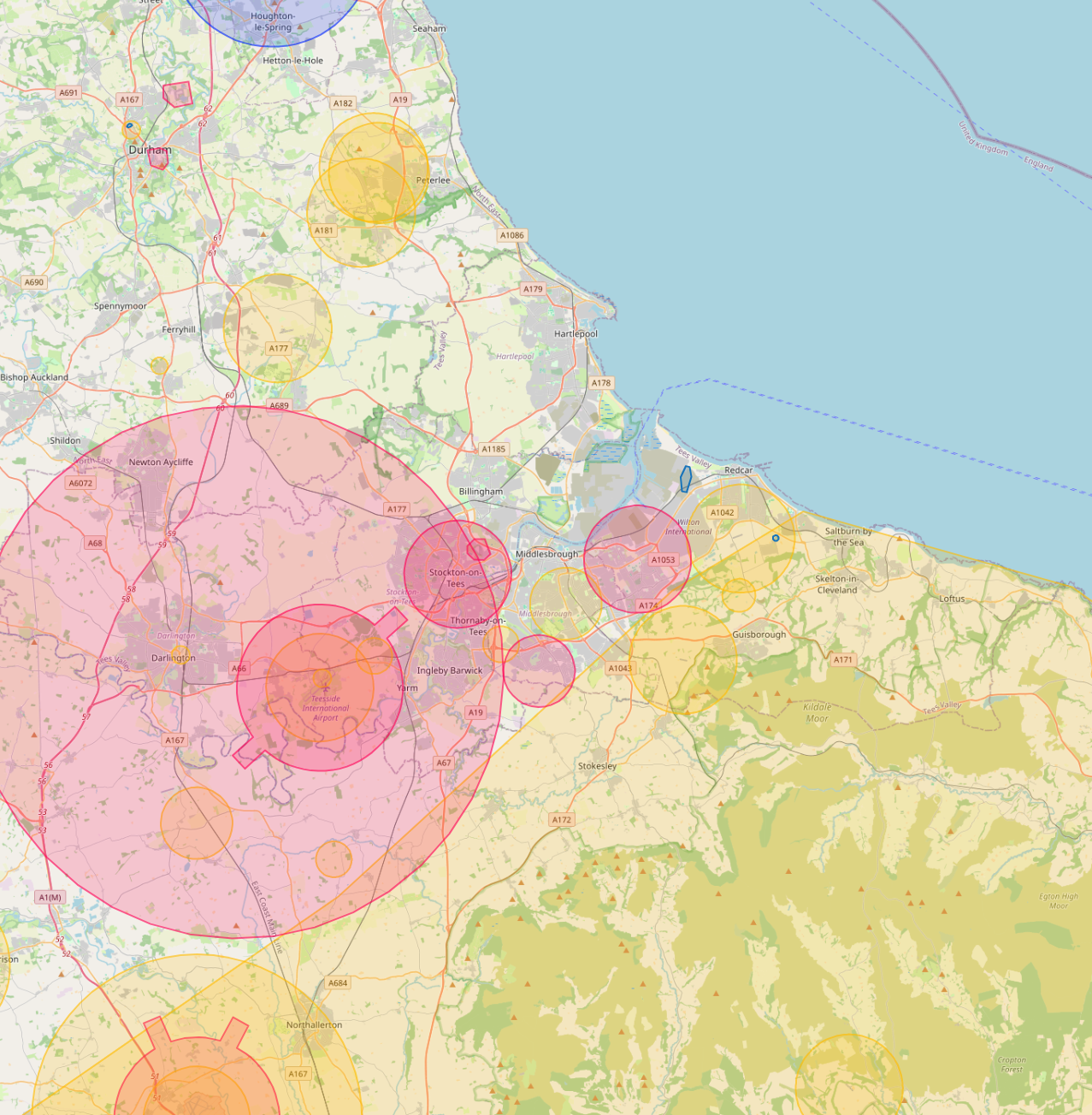
Live airspace data from Altitude Angel via Drone Safety Map. Pan and zoom to explore restrictions around your site.
Petrochemical and process industry, port, freeport zone, public-sector housing, manufacturing.
The Tees Valley is the UK's largest petrochemical and process-industry cluster. Drone inspection of pipework, storage tanks, flares and chimneys is the safest way to survey the estate without scheduling a shutdown.
Around Middlesbrough, our project pipeline regularly takes us across local authority and housing-association estates. We deliver scaffold-free roof inspections, retrofit thermography, condition surveys and BREEAM-grade thermal capture for organisations including:
Organisation names are common sector-active examples in the region. Specific client engagements are confirmed under NDA on request.
Most of the sites we're asked to fly, live commercial premises, near airports, inside Flight Restriction Zones, around Network Rail corridors, military air bases and Royal estates, require enhanced CAA permissions, prior notification, and an operator with the track record to coordinate with the relevant authority. We hold and operate under those permissions every day. If you've been told "no" elsewhere, our route to flying it is almost certainly already in place.
Every Middlesbrough project we capture is hosted on AIM Platform, the asset-information software used by surveyors, councils and contractors across the UK. Browser-streamable. Measurable in place. Shareable with one link.
Tell us the site, the deliverable, and any access constraints. Most quotes turn around within 24 hours.